
Brief Overview of Section 3 La Turbie-Cantaron
Starting at the point discussed at the end of Section 2, ie above La Turbie on the D53. On this sharp bend look for the way marker across the road, signed to La Gorra pointing up a small lane. Walk up this lane.
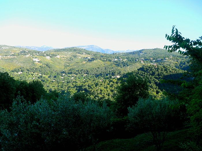
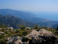
Take the first left fork. Admire the wonderful views on the left, this is where one is heading.
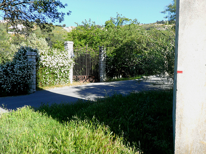
The lane comes to an end infront of a gate, take the path to the right.
It wanders down to some houses, passing a little grave with a head stone ‘Arthur’ who or what beloved animal?
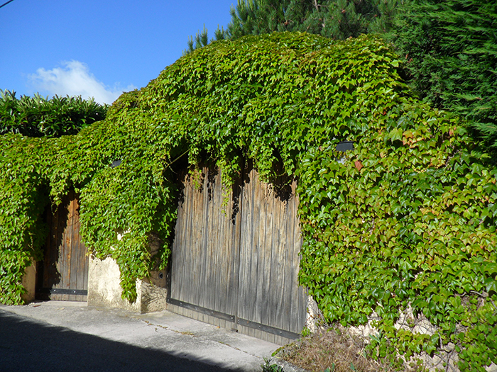
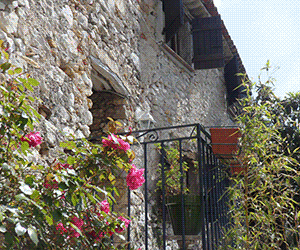
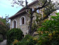
The path is quite difficult to follow here, very overgrown and not signed. Make your way downwards through some trees and finally emerging infront of a wall. Turn left on a better defined path. Be careful to continue down to the stream at the bottom, some parts are very rocky, but quite passable. Cross over the stream and go straight up the opposite bank. You emerge onto the tarmac road turn right. One passes some lovely entrances along this stretch, see photos.
Turn left at the fork and continue walking along this lane.
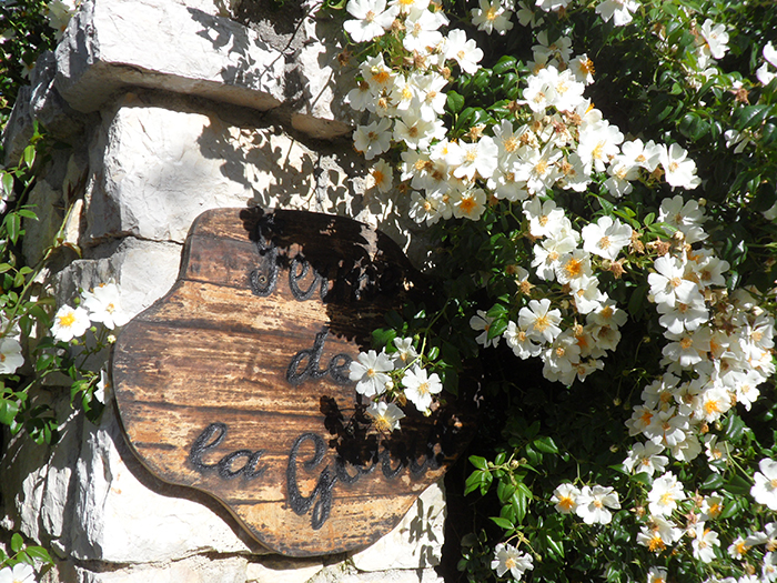
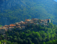
Soon after passing a water trough (fenced off!) one passes a house on the left signed La Gorra. This is the only hint that one has arrived at this point on the map.
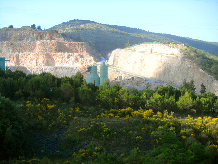
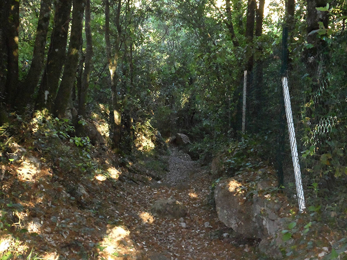
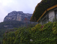
As the lane ends there is a lovely path on the left. Passing through some woodland, one emerges onto a wide open space with a large quarry in the distance. This whole area is being landscaped, with trees and has a wonderful variety of wild flowers.
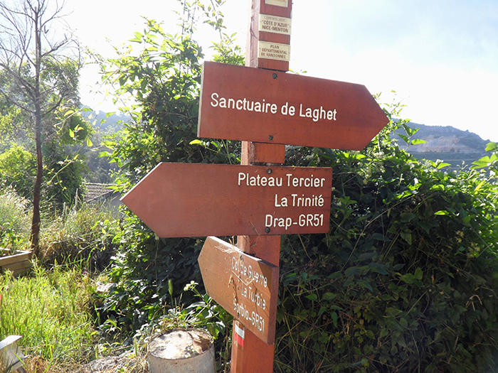
At the end of this valley the path starts to rise, very clear to follow and at the top there is a way marker for GR 653A and the GR 51. The former descends on the old Pilgrimage way towards Larghet, there is a large religious monastery here where legend has it that many miracles were performed. Accommodation can be found here.
Staying on the GR 51 branch right and follow the signs to the hamlet of Spraes.
This is a gravel road, turning into a path as one arrives at a small stream. Many prive signs! ascend through long grass. This is where I saw an enormous snake! I was told that this area is a favourite viper haunt! So shuffle your feet and sing loudly..they will slip away.
The ancient path bends left and follows along the edges of Vegetable terraces, emerging infront of a house. Turn right up the hill, there are good way markers here.
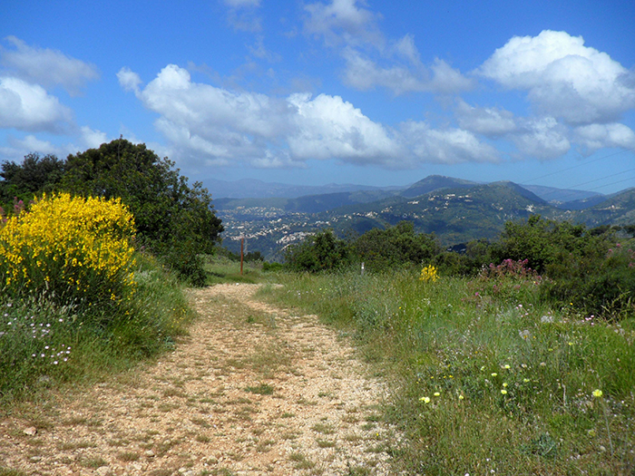
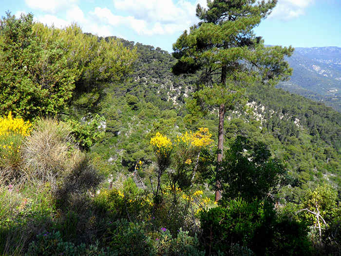
Now begins the best part of this section, slowly rising on a grass road, turning into hard surface for the hill, passing through lovely olive groves. In Spring, emerging on the crest, one is surrounded by flowering scented yellow Broom.
The path continues on a gravel road and here one has to be very careful not to miss the GR sign painted on a white pillar on the left. It is easy to walk on down the road. Turn left at the pillar and you will see a narrow path going along the fence line.
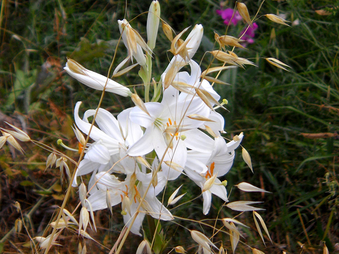
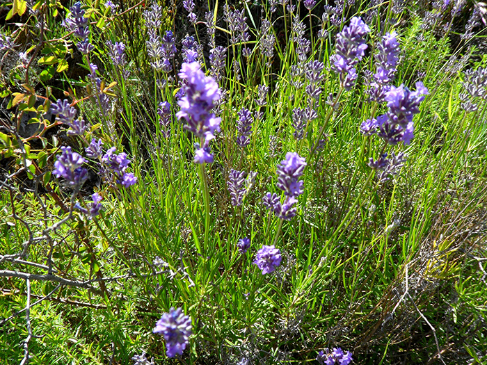
The path continues right along the whole of the Tercier Plateau. It is level throughout with far reaching views to your right across to far distant mountains.One passes a clay pigeon shoot. Note the masses of flowers and orchids, lavender and herbs and butterflies.
As one nears the end of the plateau, one comes to another gravel road, take care, and look out for the way markers, the first hidden under a tree! Continue straight ahead until you see a ‘decorated’ container on your right infront of a pylon.
Ahead there is another waymarker, but the direction board is missing. However in the grass further along you will see a marked stone. The path leaves the gravel road at this point, to the left, and immediately starts to descend.
It is a stony path but easy to follow. Olive groves to the right and some large old pine trees serve as a good marker. The path comes very near to a road, tempting as it is, stay on the path until it emerges onto the road. The path is a shorter route than the road.
Turn left on the road and at the T junction turn right. Way marked to La Colle.
You are now on tarmac until the end of this section.
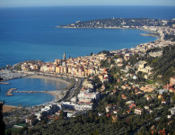
Stay on this lane passing a pretty wood cabin on the left, then more houses appear on both sides. Eventually there is a crossroads, the route is not clear here, take the turning signed Vieux Chemin du Chateau. It is a narrow lane that begins to descend steeply, and one gets views of Drap and along the valley way below.
The lane has many spurs and hair pin bends, keep your eyes open, on one bend there are 5 large dustbins, and a less used lane carries straight on to the right of the bins. Take this route.
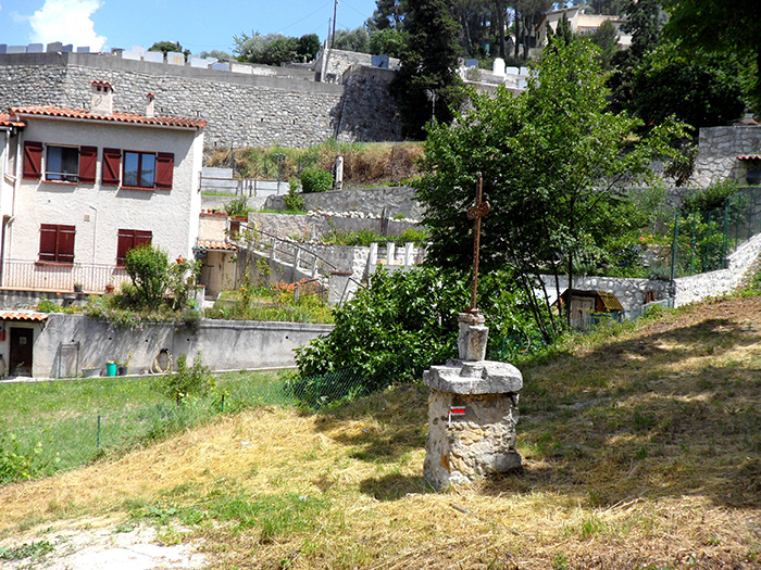
When this lane meets another road, cross straight over down the facing bank. Just afterwards in the dip is an old cross, with the GR 51 red and white sign on the base. Turn left and you soon come out on a very narrow lane leading straight down into the old part of Drap.
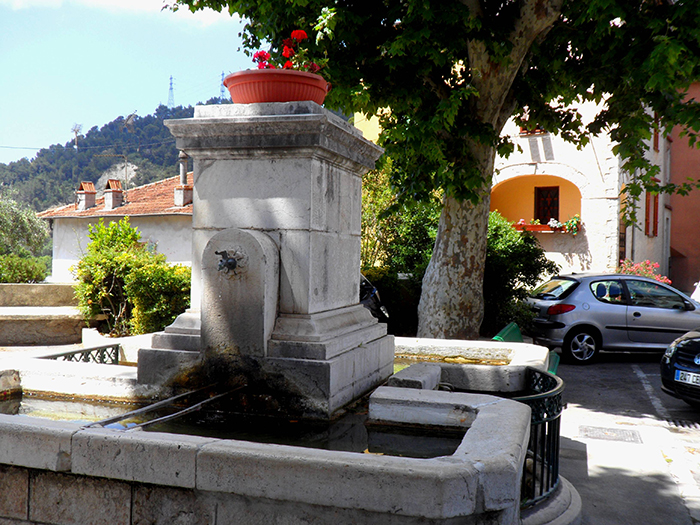
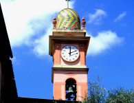
You come into the lovely small square with a fountain to your left and the church infront.
Take the very narrow lane to the right infront of the church, and soon you come out onto the main busy, noisy main road. Way marked at this point.
Turn right and stay on the main road the D2204 (do not be tempted to take the lovely road along the river….it is closed and fenced off further along)
There are many nice buildings undergoing decoration and restoration. Accommodation can be found at the Gite Rural on your left.
Turn left over the large bridge after a flower nursery. Straight ahead is the Drap-Cantaron station where you can catch a train back down to Nice. The trip takes approximately 20 mins.


No comments